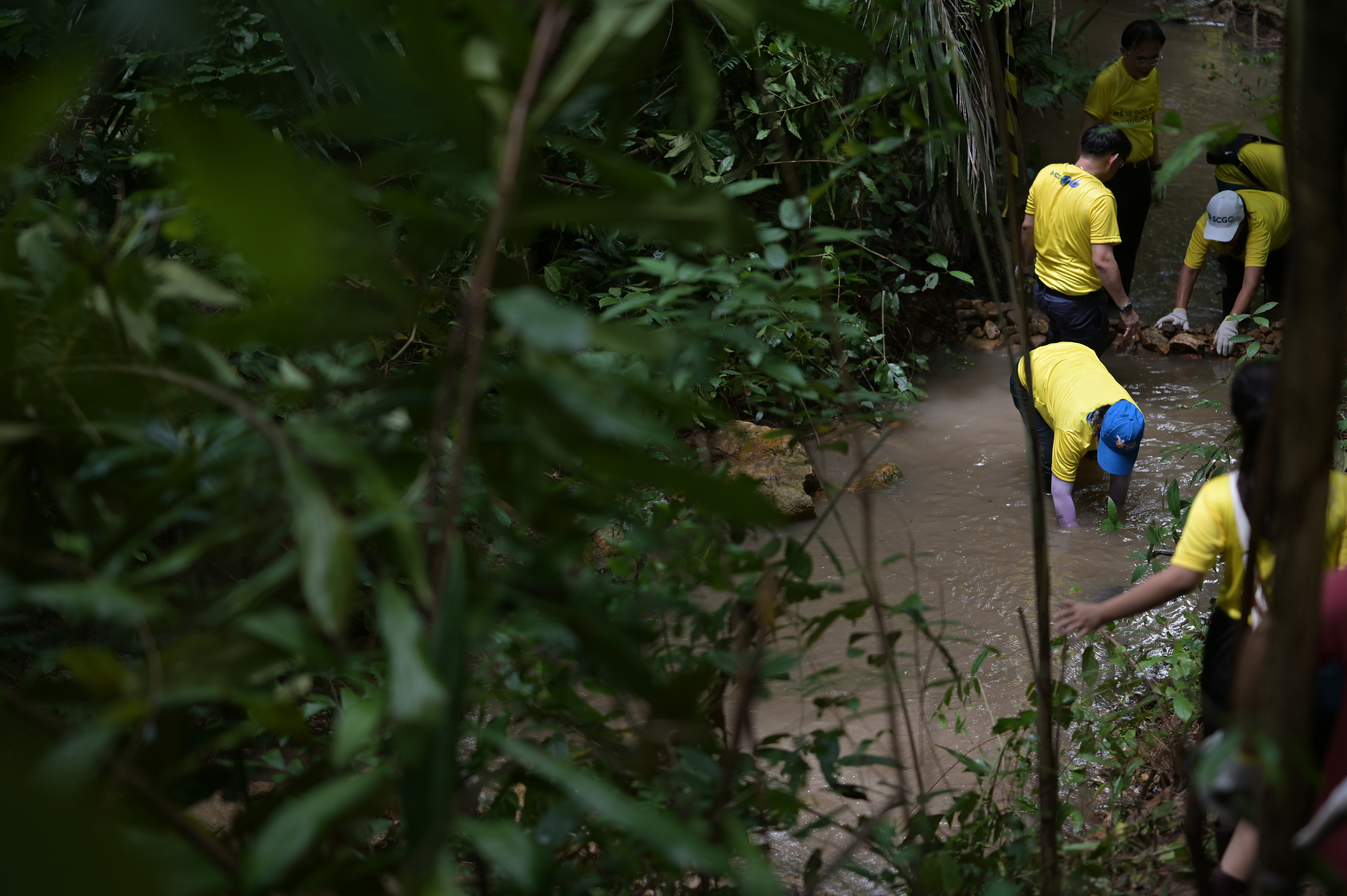
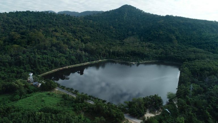
Over the past decade, SCGC has collaborated with the communities around Yai Da Mountain in Rayong province, environmental partners, the Department of National Parks, Wildlife, and Plant Conservation (Eastern Coastal Watershed Research Station), and the Biodiversity-Based Economy Development Office (BEDO) under the Ministry of Natural Resources and Environment. Together, they have been building check dams, reforesting, and undertaking a series of environmental sustainability activities to restore degraded areas from past logging concessions and address drought issues in Yai Da Mountain and surrounding communities. These efforts are part of the "Forested Watershed Rehabilitation at Yai Da Mountain" project, under the concept of “Communities with Good Water Management" with the water management model "2 Cultivate 2 Collect" to promote sustainable community water management.
"In 1988, Yai Da Mountain was threatened by wildfires as forest areas were converted into agricultural land. The fertility of the forests gradually diminished, replaced by open land. This reduced the soil's ability to absorb water, causing flash floods during heavy rains and leaving the soil dry during droughts. As a result, farmers in the surrounding areas suffered from severe water shortages for agricultural production, impacting household incomes and the overall economy of Rayong province, where agriculture is a key economic sector."
That was a portion of an interview with village headman Wandee Inthaprom, a representative of the community water management group in Ban Map Chan, Rayong province. As a community leader who bears the burdens of both his own hardships and those of the villagers, he vividly describes the environmental challenges the community faced in the past. After collaborating with SCGC to restore the natural area of Yai Da Mountain to its former fertility and develop a water management plan for sustainable community development under the concept of "Communities with Good Water Management" with the water management model "2 Cultivate 2 Collect."
In this article, we invite you to understand the construction of check dams, which is one of the key factors in addressing water issues in the watershed ecosystem of Yai Da Mountain. It serves as a valuable lesson in sustainable water management for communities, aligning with the sustainability trends of 2024 and the Sustainable Development Goals (SDGs), specifically Goal 6 and Goal 15.
Question: Will the construction of check dams impact the local ecosystem?
Answer: This question arises from the concerns of conservationists, particularly regarding certain fish species that swim upstream to lay eggs. It must be acknowledged that the construction of check dams alters the ecosystem's structure, especially the riverbed. However, we must consider whether these changes have a predominantly positive or negative impact.
To understand the context before the construction of the check dams, the observations are as follows: (1) Deforestation in the watershed areas for agricultural use reduced the soil's ability to absorb and store rainwater. The excess rainwater became surface runoff, quickly flowing into streams and eroding the nutrient-rich topsoil, resulting in murky streams; (2) Climate change has made rainfall less frequent but more intense when it does occur, often over short periods (depending on the amount of water vapor in the atmosphere). This phenomenon exacerbates the effects mentioned in point (1). At such times, all forms of life, including fish and crabs, find it challenging to navigate the streams due to the strong and murky water flow.
At the same time, as surface runoff from various areas accumulates in the streams, it leads to flash floods that erode the soil along the banks and the riverbed. This process continues as water flows down to low-lying areas, waiting for drainage, causing damage to the downstream communities. It is evident that the structure of the streams has already begun to change. Similarly, when rainwater does not permeate and accumulate in the soil, there is no groundwater to sustain the streams after the rain stops or during the drought season. This leads to water shortages, making it difficult for living beings, such as fish and crabs, to navigate the streams due to the absence of flowing water. The issues of flash floods and water scarcity prompted the construction of check dams as a solution to mitigate these two challenges.
Question: How do check dams help mitigate impacts?
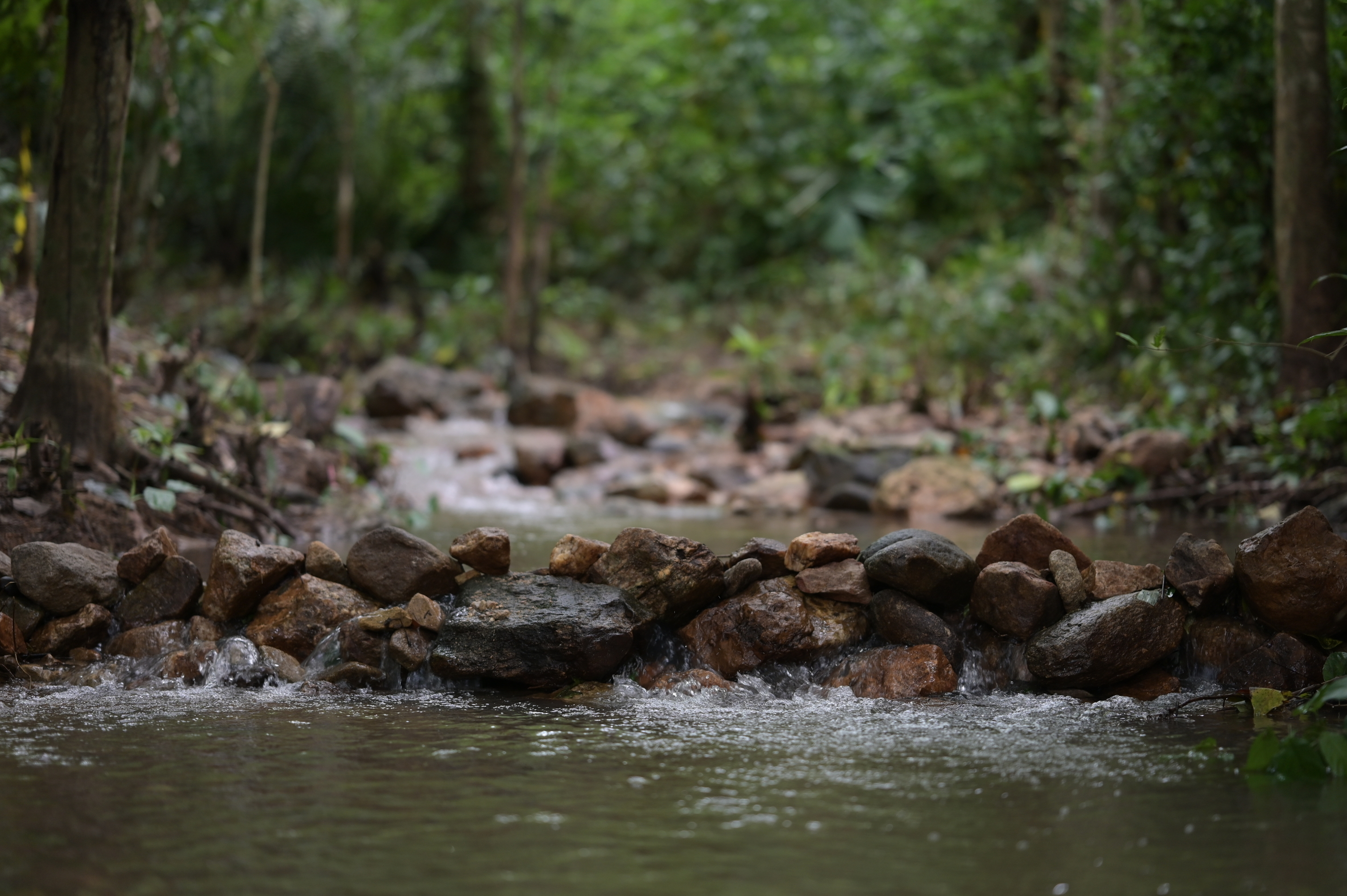
Answer: When constructed correctly according to scientific principles, check dams can slow the flow rate of streams by up to 90% and at least 40%, depending on the water current speed. Additionally, they help reduce the murkiness of the stream water by allowing suspended sediments to settle. If the water has the opportunity to remain still for just 40 seconds, sand particles will settle to the riverbed. Even if sediment accumulates in front of the check dam, as long as the flow rate does not exceed 0.08 cubic meters per second, there will be no movement of sand particles along the riverbed. These figures are based on research findings.
Beyond slowing the flow rate and reducing water murkiness, the still water has the chance to seep into the ground beneath the riverbed and gradually flow downstream. This process has led to the continuous presence of water in wells around the base of Yai Da Mountain, which were previously dry before the construction of the check dams. This is an observable fact for the communities around Yai Da Mountain. The water also seeps into the banks of the streams, promoting tree growth and increasing their health by 6.55-14.08%, as indicated by the change in NDVI values. This data, derived from satellite imagery, compares the conditions before and after the construction of the check dams.
Question: Can we avoid building check dams and only focus on reforestation or afforestation?
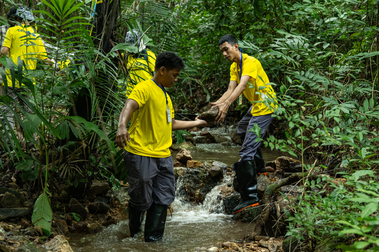
Answer: While it is possible, it would take an incredibly long time, spanning tens of thousands of years. In nature, the close relationship between soil, water, and forests results in three simultaneous and ongoing processes that gradually transform barren rocky areas into rich natural forests over hundreds of thousands of years. This begins with the breakdown of rocks into small particles that absorb moisture (the process of water accumulation in the area), the settling of plant reproductive cells, and the growth and development of vegetation (the development of plant communities). As plants die, their remains mix with rock fragments to form soil (the soil formation process), which becomes finer and more capable of retaining moisture or water. This cycle repeats continuously.
However, constructing check dams accelerates these processes by rapidly increasing the water supply to the area. This boosts tree growth and facilitates the regeneration of lost soil, allowing the land to retain more water. Most importantly, check dams mitigate the impact of floods during the rainy season and increase water supply during drought periods. According to SCGC's studies at Yai Da Mountain, about 30% of the necessary check dams reduced floodwater by 2.75% and increased water availability during the dry season by 7.48%, extending the flow of water in streams by an additional three months.
For fish and crabs, they were unable to navigate or found it difficult to move around due to floods during rainfall and dried-up streams after the rain stopped. The consistent water flow in front of and behind each dam now facilitates easier movement for crabs, as evidenced by a noticeable increase in their population. Fish, on the other hand, may need some time to adapt, similar to unruly elephants at Khao Chamao National Park, which were relocated to the borders of five provinces to modify their behavior and managed to return to Khao Chamao within a few days.
Question: What are the correct principles for building effective check dams?
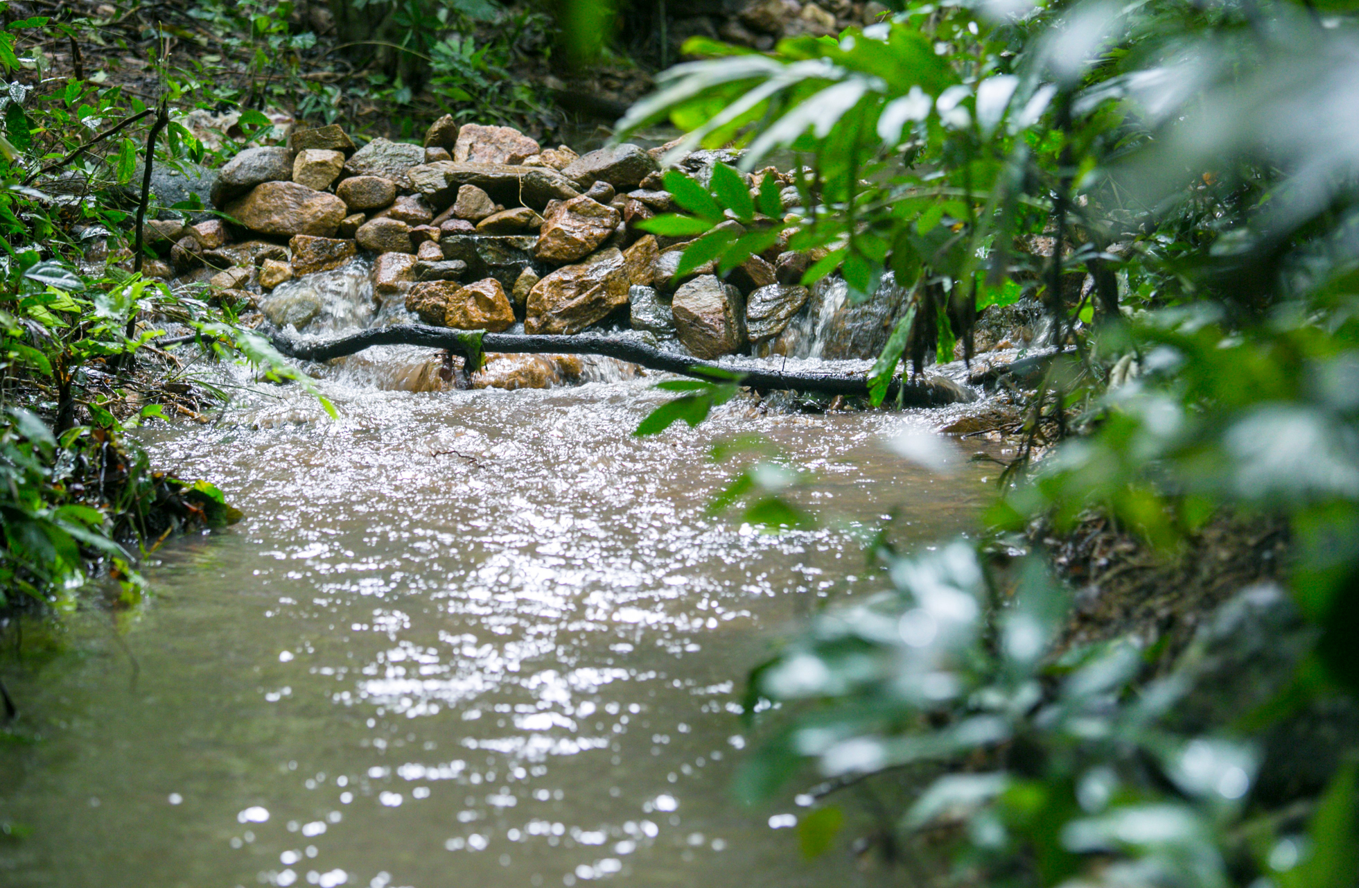
Answer: According to FAO studies, the most efficient and cost-effective check dams should meet the following criteria: First, the crest of the dam should not exceed 60 centimeters above the riverbed, and it should have a thickness of approximately 3 feet or 1 meter. The base of the dam should be three times the height of the crest to prevent the impact of water in front of the dam and avoid backflow and erosion at the back of the dam. Second, the dam crest should have bumps or rectangular channels to drain floodwater, with the size of these channels determined by the maximum flow rate data. Finally, the height of the lower dam's crest should align with the base of the upper dam.
Question: Does SCGC collaborate with the government and experts in building check dams, and how is the monitoring and evaluation conducted?
Answer: SCGC collaborates with experts in conservation and watershed management from the Department of National Parks, Wildlife, and Plant Conservation as advisors for the Forested Watershed Rehabilitation at Yai Da Mountain project. They have conducted research to assess the impact of supporting the surrounding communities in building check dams at Yai Da Mountain. Over four consecutive years (2007-2010), a total of 1,239 check dams were constructed out of a planned 18,464 dams. SCGC's studies have revealed the following interesting findings:
- Shallow wells in the foothill areas and lower slopes of Yai Da Mountain now contain water year-round, whereas they used to dry up annually during the dry season.
- The check dams have reduced water flow rates by up to 90% and at least 40%.
- Even when sediment accumulation in front of the dams is significant, they still reduce water flow by 40.36%.
- The dams have decreased sediment murkiness in the water by 58.33%.
- The amount of water stored in the soil has increased by 10.41%.
- Satellite imagery data, specifically the Normalized Difference Vegetation Index (NDVI), indicates that the construction of check dams has increased forest growth by 6.55-14.08%.
Question: How does the construction of check dams under the Forested Watershed Rehabilitation at Yai Da Mountain project demonstrate ESG (Environmental, Social, and Governance) impacts?
Answer: ESG stands for Environment, Social, and Governance, and it is a concept related to the sustainable development of organizations. The Forested Watershed Rehabilitation at Yai Da Mountain project, carried out by SCGC in collaboration with the local communities around Yai Da Mountain in Rayong province, the Department of National Parks, Wildlife, and Plant Conservation (Eastern Coastal Watershed Research Station), and the Biodiversity-Based Economy Development Office (BEDO), has significantly restored water resources in streams, increasing water volume by 512.48 cubic meters per rai per year, or 14.83 million cubic meters per year. The project has also increased tree density, with the discovery of 120 plant species and habitats for 123 wildlife species. Additionally, the project has contributed to mitigating global warming, reducing the average annual air temperature by 1.6 degrees Celsius, storing 38.49 tons of carbon per rai, and absorbing 5.41 tons of carbon per rai per year.
In the social dimension, this project has significantly benefited farmers in the communities surrounding Yai Da Mountain, Rayong province, by providing water to sustain over 10,620 rai of agricultural land. This has resulted in a total production of 79,382,695 kilograms per year. The project has also led to the establishment of community-based tourism enterprises, generating a tourism value of 538.54 baht per rai. This initiative invites tourists to experience the richness of nature, shop for community products, and participate in various eco-tourism activities, promoting the concept of sustainable local water management to visitors.
The Forested Watershed Rehabilitation at Yai Da Mountain project also addresses governance aspects. The community has actively participated in mapping their water resources, engaging in discussions on dam construction, water management, and community sustainability. These discussions are grounded in inclusivity and facts. Furthermore, the community has collaboratively established rules for shared water usage, fostering internal collaboration that drives the community toward sustainable strength and aligns with the sustainability trends of 2024.


